


 Recommend YouTube


| View : |  | ||
| Difficulty : |  | ||
| Path : | |||
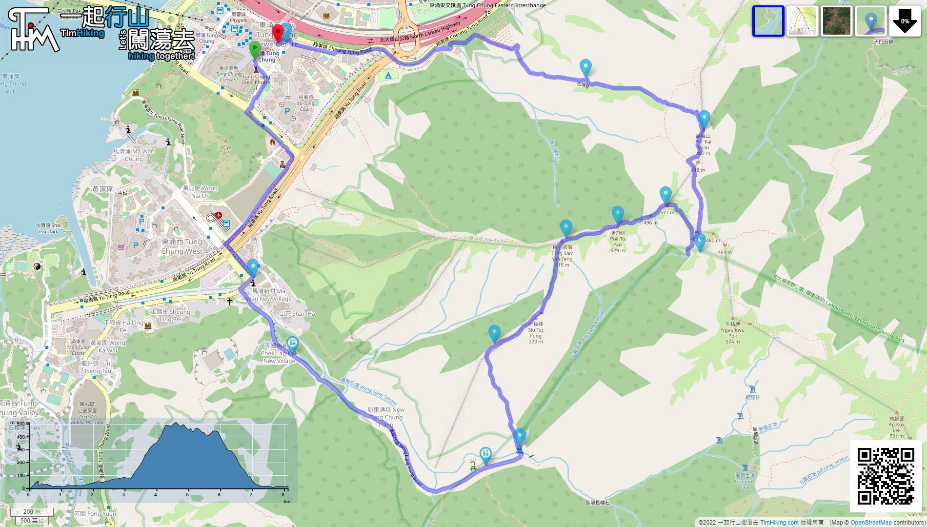
| Length : | 8.2km | ||
| Time : | 5hours | ||
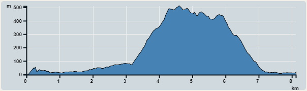 | |
| Ascent : 733m | Descent : 720m |
| Max : 509m | Min : 0m |
| (The accuracy of elevation is +/-30m) | |


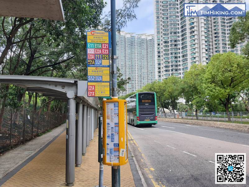
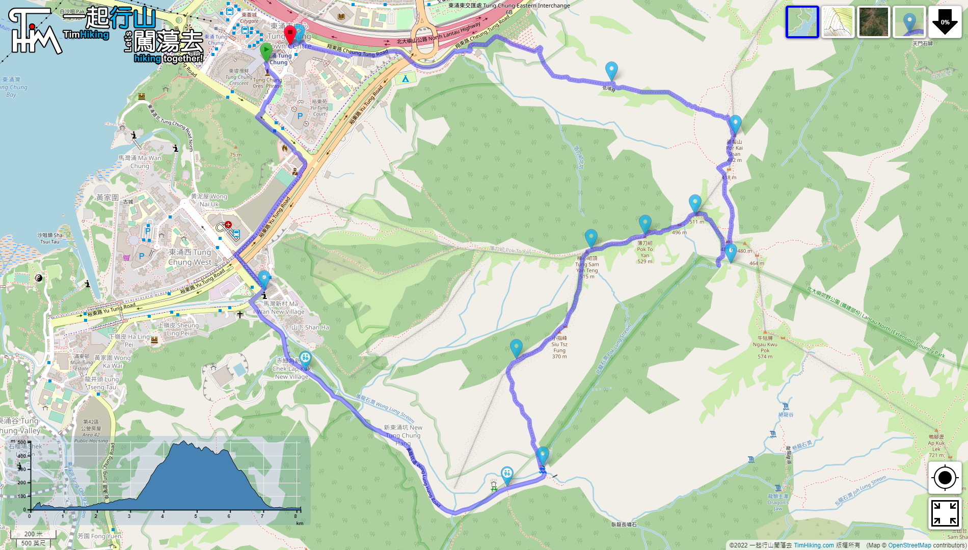
The starting point is in Tung Chung, take the airport bus line E which will be closer, and get off at Tung Chung Fire Station.
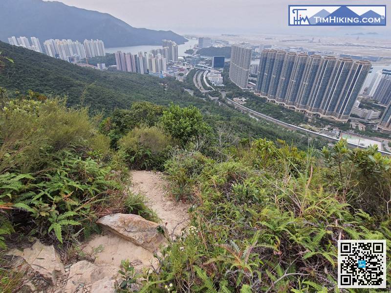
 28︰The entrance to the barren trail of Po To Yan is on the left-hand side of the top of the steps. Do not keep right after going up the steps, or you will walk along the stream.
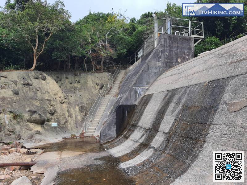
First, go up the narrow steps next to the Pak Lung Stream embankment.
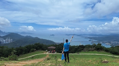
53︰and after passing through, you will come to Tung Sam Yan Teng. Tung Sam Yan Teng is 515 meters high, there is no trigonometrical station, the location on the top of the mountain is very small, and it cannot stand too many people. 62︰But after turning a corner, you came to Po To Yan, which is 529 meters high there is an old trigonometrical station
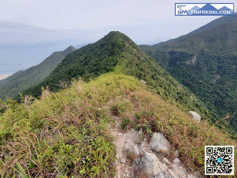 71︰When you go to a big rocky flat, here is a fork,
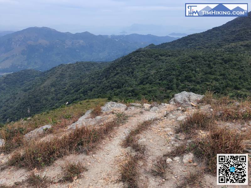
Come down the mountain on the other side, go to the source of Pak Lung Stream,
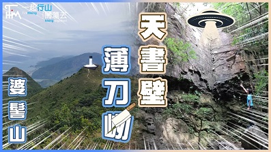
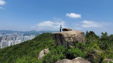
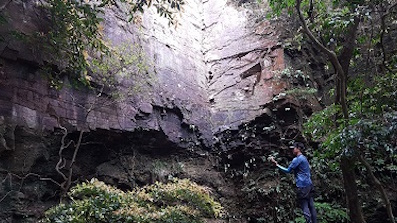
80︰Heavenly Book Wall is an important attraction! Two ten-meter-high straight cliffs are placed side by side at a 90-degree angle, and together with layered textures, it seems to form a magnificent book from the sky.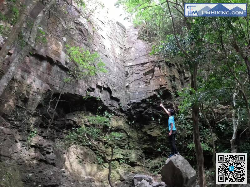
Heavenly Book Wall is an important attraction! Two ten-meter-high straight cliffs are placed side by side at a 90-degree angle, and together with layered textures, it seems to form a magnificent book from the sky.
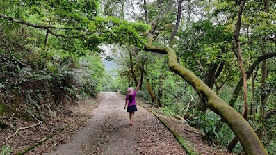
92︰and pay attention to the small mountain trail on the right, the entrance is not obvious, and you must observe carefully. 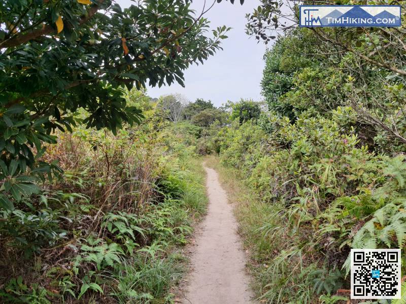 108︰After about 10 minutes, it will take you back to the main road, which is also a crossroad, and turn right towards Pak Mong,
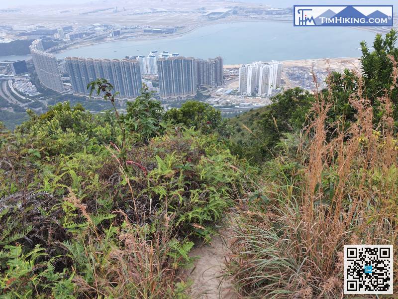
On the way, you can walk down the Caribbean Coast,


